Chiapas
Hello from Xela, Guatemala! This second and final Mexican installment covers our all-too-brief visit to the state of Chiapas.
Zapatismo
In prehistoric times before broadband internet, my grandfather would pass me his copy of Time magazine every week, and I would read the thing from cover to cover. Because of this, Chiapas was one of the few places in Mexico that I was aware of prior to this trip.
In 1994 a young ideologue known as Sub-Comandante Marcos led an armed uprising of indigenous farmers in Chiapas against the Mexican government. The Zapatista insurgency was quickly put down, but the social problems that gave rise to it never went away, and neither did the Zapatistas. These days, the organization known as EZLN seems to encompass everything from social activists in the cities to armed bandits in the jungle.
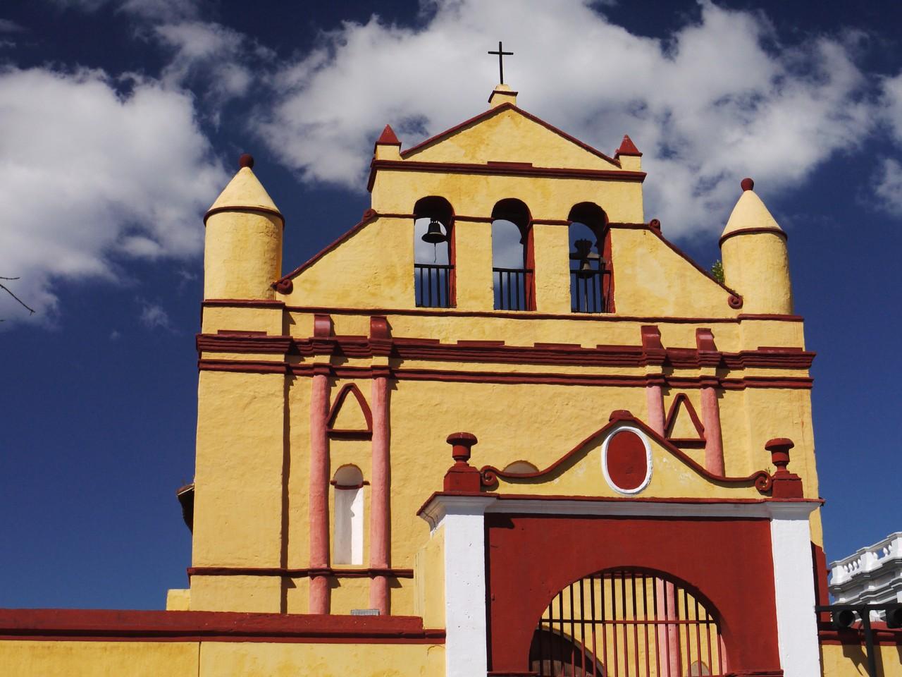 The cathedral in San Cristobal de las Casas
Our own encounters with the Zapatistas were completely benign. Their political wing operates freely, and EZLN-branded souvenirs are everywhere, with Che Guevara’s portrait often pasted next to the masked figure of Sub-Comandante Marcos for good measure. A Zapatista-affiliated “cultural center” in San Cristobal doubles as a very handy restaurant.
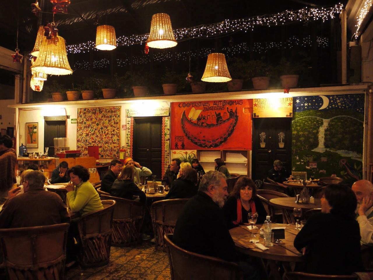 Tierradentro, a Zapatista restaurant in San Cristobal
We did take some precautions to avoid running into the other aspect of the movement. The green hills around San Cristobal were practically screaming to be climbed, but we couldn’t find anyone in the city who thought this would be a good idea. A few people who ventured out there either got lost or got robbed, and guided trips from the city tend to stay on the routes connecting different settlements rather than head for the peaks. The hiking plan was thus grudgingly abandoned, to be picked up again when the odds are more in our favour.
Festival Season
By sheer luck, we arrived in Chiapas during peak festival season. Latin America is very serious about its festivals: typically, every village will have its own fiesta, its own customs, and its own unique dress. We visited two events, both taking place as part of the festival of San Sebastian. In Zinacantan, everyone was out on the street in their traditional costume (worn even when there’s no festival on), a blue-and-purple embroidered garment with or without tassels attached. A sort of street parade was taking place: first it was cowboys riding horses at top speed back and forth, miraculously managing to avoid trampling any of the children. This was followed by a group of villagers dressed up as jaguars and other creatures, marching backwards (for some reason) through the street, banging drums and mimicking animal calls.
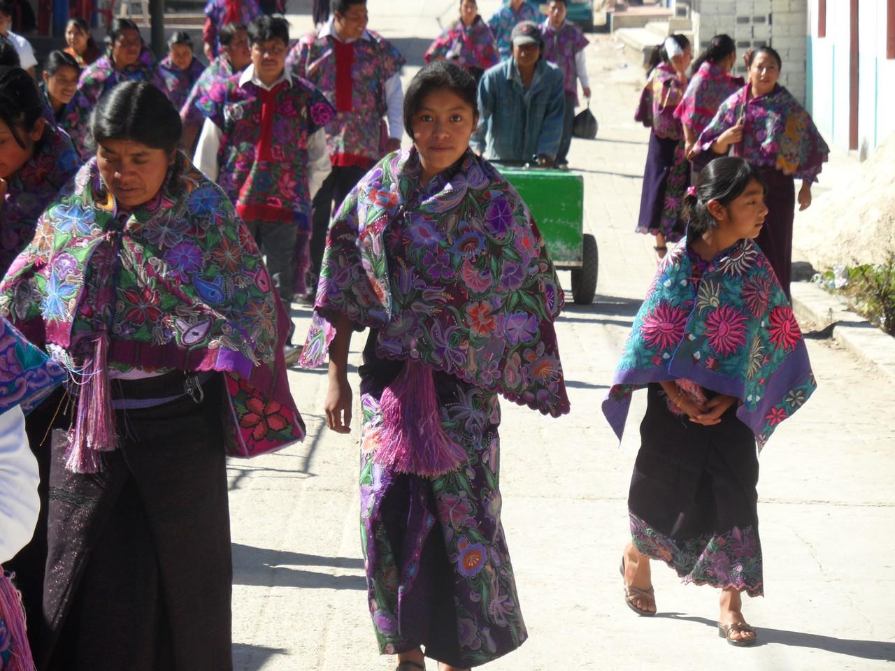 Traditional dress in Zinacantan
That event was relatively tame compared to the situation in Chiapa de Corzo the following day. The parachicos tradition commemorates a time following the Spanish conquest when indigenous men were forbidden from entering the cities, occasionally managing to sneak in by dressing up as women. The tradition involves villagers dressing up in colorful tunics, blond helmet-shaped wigs, and full face masks, marching through the streets with noisemakers and gladly posing for pictures with the hordes of mostly domestic tourists who flock to see the event. Eventually all the parachicos attempt to fit into the local church simultaneously for a religious-service-come-dance-extravaganza.
Hats off to the Chiapanecos for putting on one hell of a show.
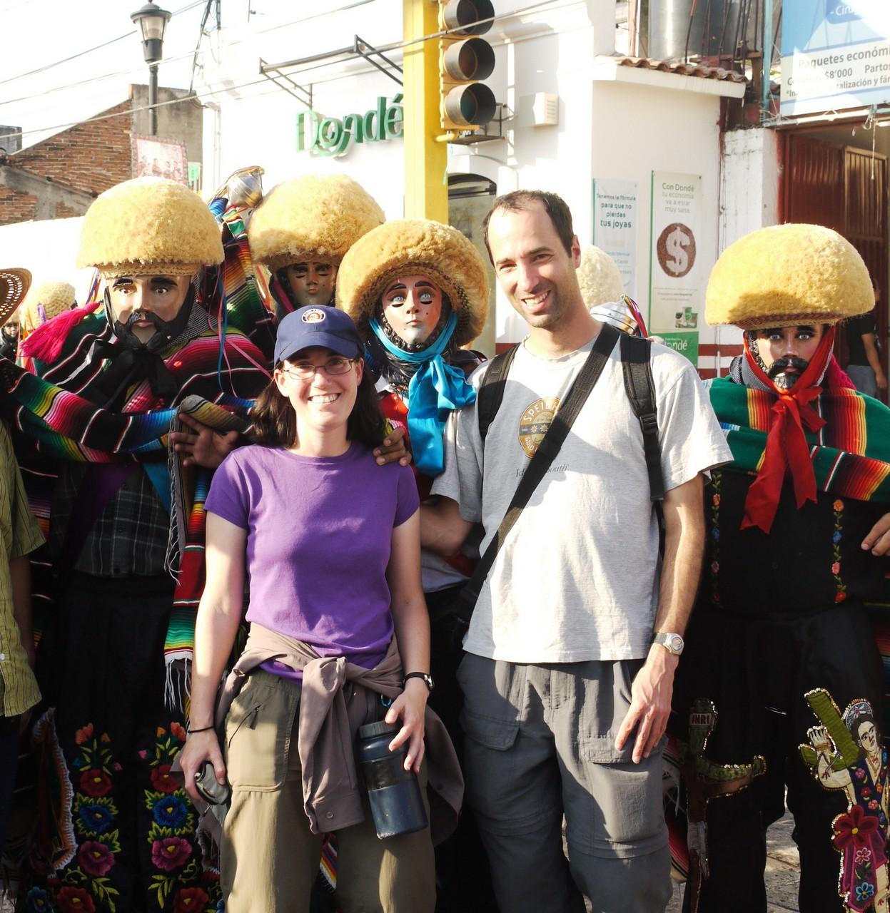 Parachicos and viajeros
Basura
Basura - Spanish for “garbage” - is one of the first words we learned, due to its frequent appearance on trash cans and on highway signs imploring people not to throw their refuse out the window. The signs aren’t working. The amount of wayside garbage in some places is staggering - easily worse than anything in Israel, and approaching the regrettable situation we witnessed in Romania.
In an ironic twist, the prime natural attraction that draws tourists to the state of Chiapas is also a focal point for garbage. The Cañon del Sumidero is a beautiful sight, so long as you only gaze upward from the water at the kilometer-high cliffs above. At water level, it might as well be a repository for empty beverage containers. The configration of water currents in the area ensures that floating garbage from Chiapas and parts of Guatemala arrives at the Cañon del Sumidero and stays there, overwhelming the government’s permanent cleaning operation. Our guide explained that the only solution to the problem is to change people’s attitudes. Or at least that’s what we think he said - he was speaking in Spanish, and our listening comprehension skills are very rudimentary.
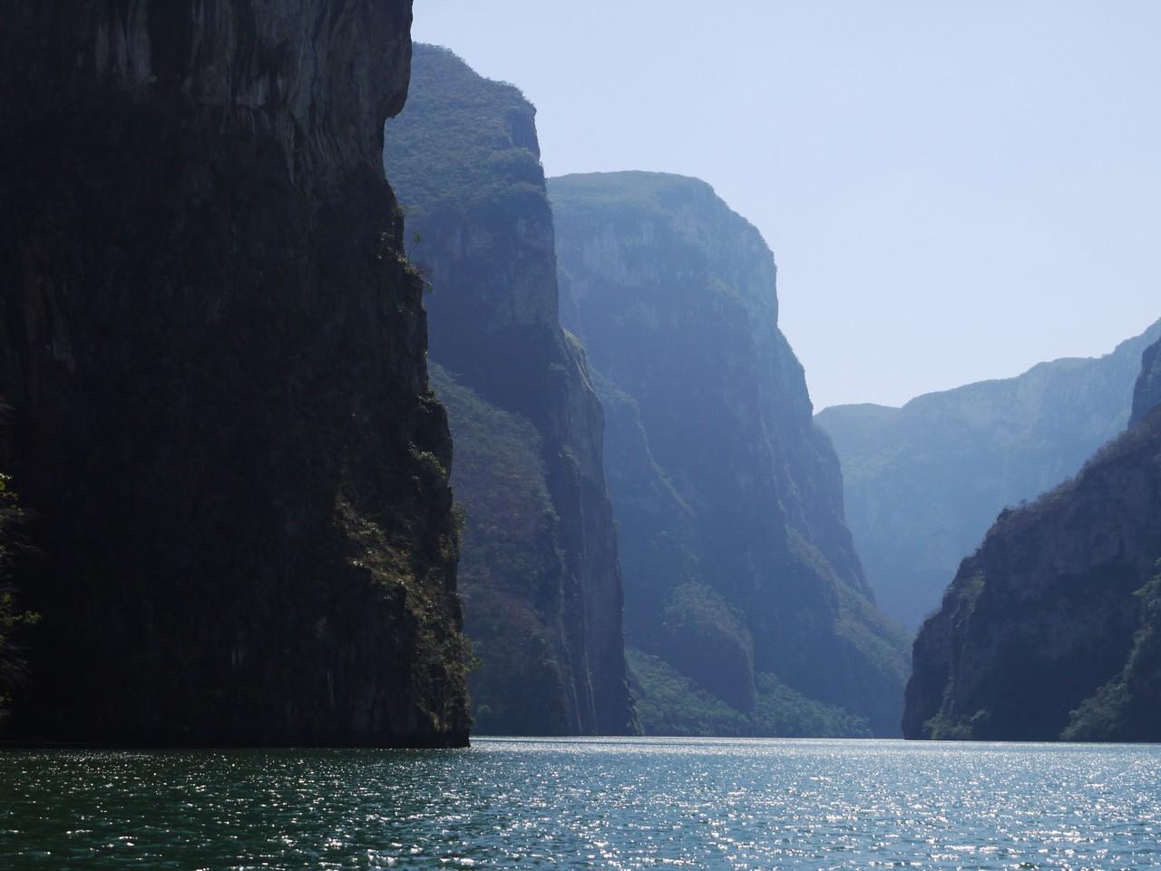 Cañon del Sumidero
 So much floating garbage...
Palenque
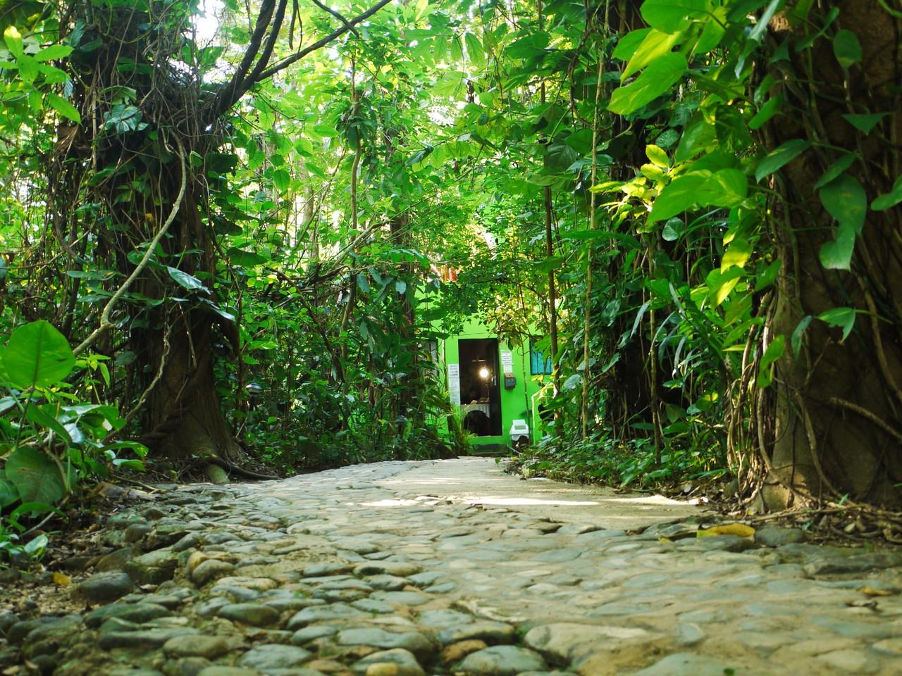
Palenque is a beautifully restored Maya city surrounded by thick jungle, with an interesting museum and trails in the forest. A small settlement near the ruins (just a group of lodges, really) called El Panchan draws the alternative crowd like a magnet. El Panchan is a good place to enjoy the sights and sounds of the jungle, but it was somewhat too small and quiet for us - not exactly a happening place, so we moved on after just one night. Perhaps we’d appreciate the place more had we not turned down the offer to buy LSD from the guy standing near the gate. As we later learned, there are also psychoactive mushrooms to be had in Palenque, and they are said to be some of the best on the market.
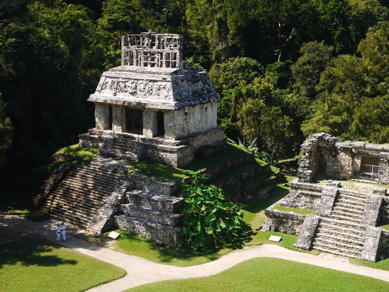 Temple of the Sun, Palenque
Trip Aids
This is our first time traveling with a Footprint guidebook (the Central America Handbook 2011 edition). Normally we are Rough Guide types, falling back on Lonely Planet when no Rough Guide is available. The Handbook is a compact, hardcover package with flimsy pages and somewhat more detail than the competition, but it is organized in an strange manner, and occasionally not organized at all. For some reason the editors chose to separate the descriptive sections from the “listings”, so to answer the question “do I want to visit this place and if so how do I get there” you need to flip back and forth between two locations in the book. They are also rather stingy with maps, choosing instead to spend their real estate on free-text descriptions of relationships that a small map would make abundantly clear. A characteristic passage reads:
The Pan-American Highway heads west out of the capital passing through Chimaltenango and on to Los Encuentros where it turns north for Chichicastenango, Santa Cruz del Quiche, Nebaj and the Ixil Triangle, and south for Solola and the Lake Atitlan region. It continues to the western highland region of Quetzaltenango, Totonicapan, Huehuetenango and the Cuchumatanes Mountains.
 The office at Margarita and Ed's, El Panchan
There are also occasional typos, sites of interest appearing only in the “getting around by bicycle” section, local words used without explanation (such as “zocalo” and “huipiles”), and other glitches. We picked up an abandoned copy of the 2010 Lonely Planet Guide in Isla Mujeres, for use when the Handbook’s prose becomes too obscure.
Another travel aid we used is a set of audio lessons in Spanish. We started going through them prior to the start of the trip, but didn’t get very far. The vocabulary is apparently tuned for romantic encounters, focusing on statements such as “let’s go have a beer, I’ll pay” and “my husband isn’t here, we have one hour”.
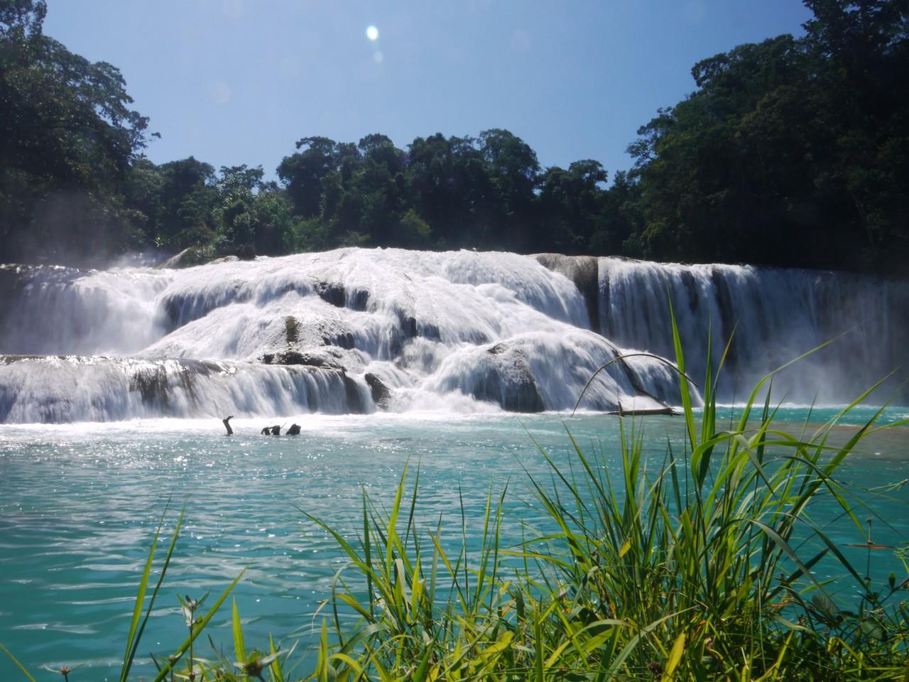 Agua Azul
More Chiapas photos here.
Next report: ground-level Guatemala.